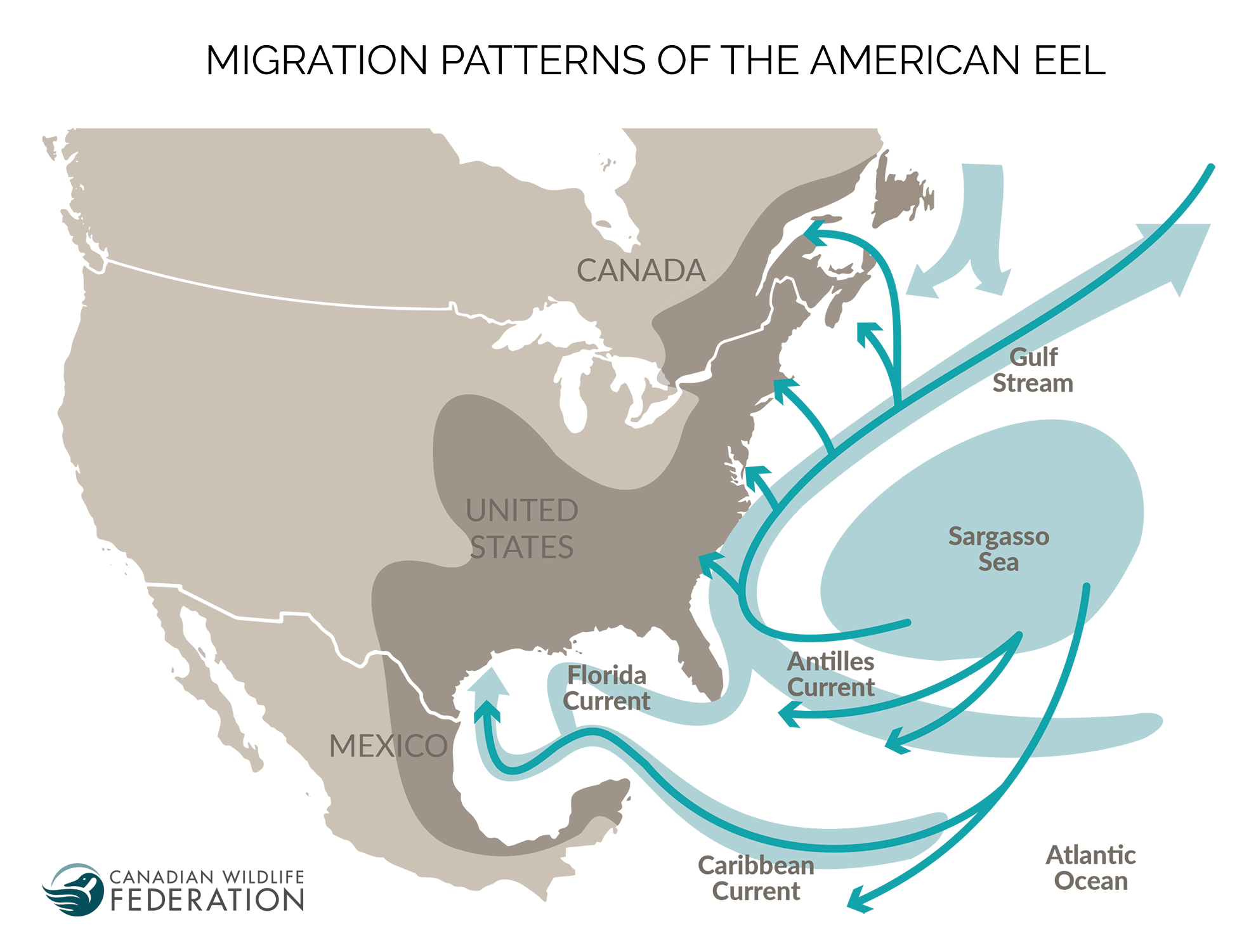
The American Eel is a protected species that spawns at sea and matures in rivers and lakes along the East Coast of North America.
Here, I will use Geometric Network Analysis to show the potential impact of a new dam constructed on the Annapolis River in Nova Scotia, Canada. Annapolis river drains to the Annapolis Basin, which connects by a small inlet to the Bay of Fundy. The possibility of a new dam is bad news for the American Eel, who will now be unable to travel downstream to the ocean in order to spawn. Additionally, the could have significant financial impact on the local economy, as the Amerian Eel fishery in Nova Scotia has an estimated value of $40 million per year.
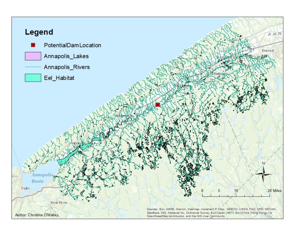
The habitat of the American Eel in Nova Scotia is shown in Figure 2. Some of these areas are home to the American Eel, which as juveniles are often called “Elvers”. There is a proposal to put a dam at the area marked with the red square; in this analysis I will describe the potential impact of this dam on the local Elver habitat by using the Trace Upstream Trace Task in Network Analysis.
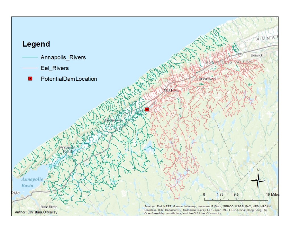
As shown in Figure 2, the impact on the waterways that flow to the Annapolis River may be significant. The layer Eel_Rivers (“EelRivers”) was created from data selected using the Trace Upstream task in Network Analysis, shown in Fig 3. This layer describes the tributaries that are upstream of the proposed dam location given in the assignment. The total length of the Eel_Rivers as calculated by the sum of the Eel_River tributary lengths is 1,466,580m (which is just over 911mi).
In order for the Elvers to complete their life cycle, they must use these rivers as conduits to access their habitats in lakes (and places with relatively still water). In order to understand the amount of habitat in the Annapolis Valley that will no longer be connected to the Bay of Fundy, I will use the Intersect by Location tool to identify lakes that are within the network of streams and rivers upstream of the proposed Dam. The result of this analysis is shown in Figure 4.

The layer Eel_Habitat_Lakes (“EelLakes”) was created from data selected using the Select by Location tool, and is shown in Figs 4, 5, 6. This layer then describes the lakes associated with tributaries that are upstream of the proposed dam location given in the assignment. The total area of the Eel_Lakes as calculated by the sum of the Eel_Lake areas is 45,831,406m2. It is interesting to note that the total lakes in the Eel_Habitat in this area is 119,962,939m2, which means that the potentially affected area is 38.2% of the total Eel Habitat in the Annapolis River Valley.
The proposed dam impacts about 38% of the current habitat of Elvers. The total habitat in the area is 120 million square meters, and the impacted area is 46 million square meters. This eliminates a significant amount of the upstream habitat, and would increase the competition of Elvers downstream. The brief I recieved before completing this project indicated that Elvers have been experiencing decreasing population numbers recently, and the dam may present an obstruction that will almost certainly reduce numbers further. This impact would be nearly immediate, as Elvers who are upstream of the dam when it is blocked off will be inhibited from reaching the sea to spawn, thereby reducing the population of adults who can reproduce.
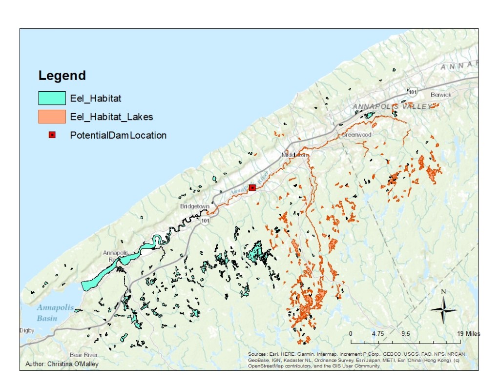
Figure 5 gives a good visualization of the lake habitat impacted by the proposed dam. In addition to the fact that 38% of the current habitat is impacted, so is the areas furthest from the Bay of Fundy to the southeast.
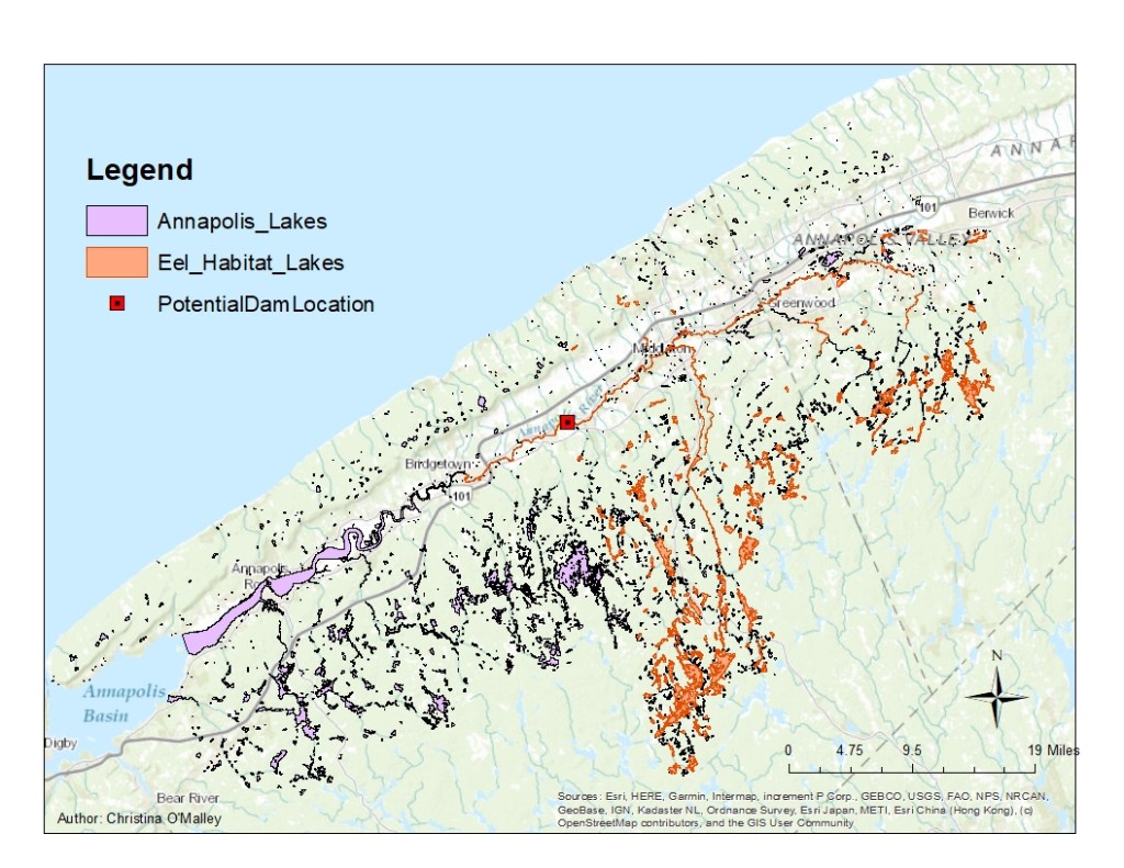
An interesting artifact in this data is that part of the river is colored orange (Figure 6), despite being downstream from the dam. This requires further investigation. This species of Eel prefers to live in still water, and its possible that the downstream river dynamics could change, but I don’t think this analysis is picking that up. I think its more likley that the segment of river is classed as a “lake”, which is why in Figure 3 the river is divided correctly.
 Christina O'Malley, PhD